 Get a Quote
Receiver
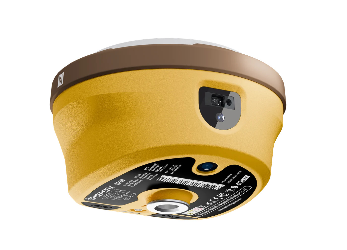
SP30 GNSS Receiver
Compact. Powerful. Precise.
SP30 is an advanced GNSS RTK receiver for visual stakeout, laser-assisted measurement and high-accuracy field positioning. It is suitable for surveying, construction layout, GIS collection and demanding B2B demonstrations.
Overview
SP30 is an advanced GNSS RTK receiver for visual stakeout, laser-assisted measurement and high-accuracy field positioning. It is suitable for surveying, construction layout, GIS collection and demanding B2B demonstrations.
Specifications
+/-(8 mm + 1 ppm)Real-time positioning precision<2 cm within 60 degreesTilt or core module performance1408 channelsFull-constellation support4G, Bluetooth, Wi-Fi, 5W LoRa 410-470 MHzCommunication and data linkIP68 / 1.5 mRuggedness or deployment detail
Key Features
Feature summary for model comparison and purchase evaluation.Full Satellite Signal Support
1408 channels track major GNSS constellations and frequencies for reliable RTK performance.
AR Real-Scene Stakeout
Built-in wide-angle camera supports visual stakeout, making target navigation more intuitive in the field.
Laser-Assisted Surveying
Integrated laser ranging and IMU compensation help measure points in complex or hard-to-reach locations.
Long Field Endurance
Large-capacity battery supports extended rover operation for full-day survey workflows.
Applications
Use this section to match the product with real overseas buyer requirements.
Land Surveying
RTK measurement, stakeout, topographic survey and field data collection.

Construction Layout
Site positioning, road work, infrastructure layout and earthwork workflows.

GIS Mapping
Efficient data collection for GIS, assets and mapping projects.

Precision Agriculture
Field positioning support for agriculture and land operation.

Infrastructure
Road, utility, bridge and project control workflows.
Accessories
Accessory choices depend on model, application, target country and package requirement. Confirm the final configuration with Spherefix sales before quotation.
Data Controller
Match receiver with C100T, C500 or required field controller.

External Radio
Confirm radio, NTRIP or local correction workflow.

Pole / Tripod
Select field mounting accessories for survey operation.

Battery & Charger
Confirm package list and spare battery requirements.

Carrying Case
Packaging and protection for delivery and field use.
Radio Antenna
Choose radio antenna options for local correction workflows.
Resources
Request product files for evaluation, quotation and distribution.Need price, distributor support or product files?
Send model, target country, quantity and application. Spherefix sales will recommend the right product path.