 Get a Quote
SLAM
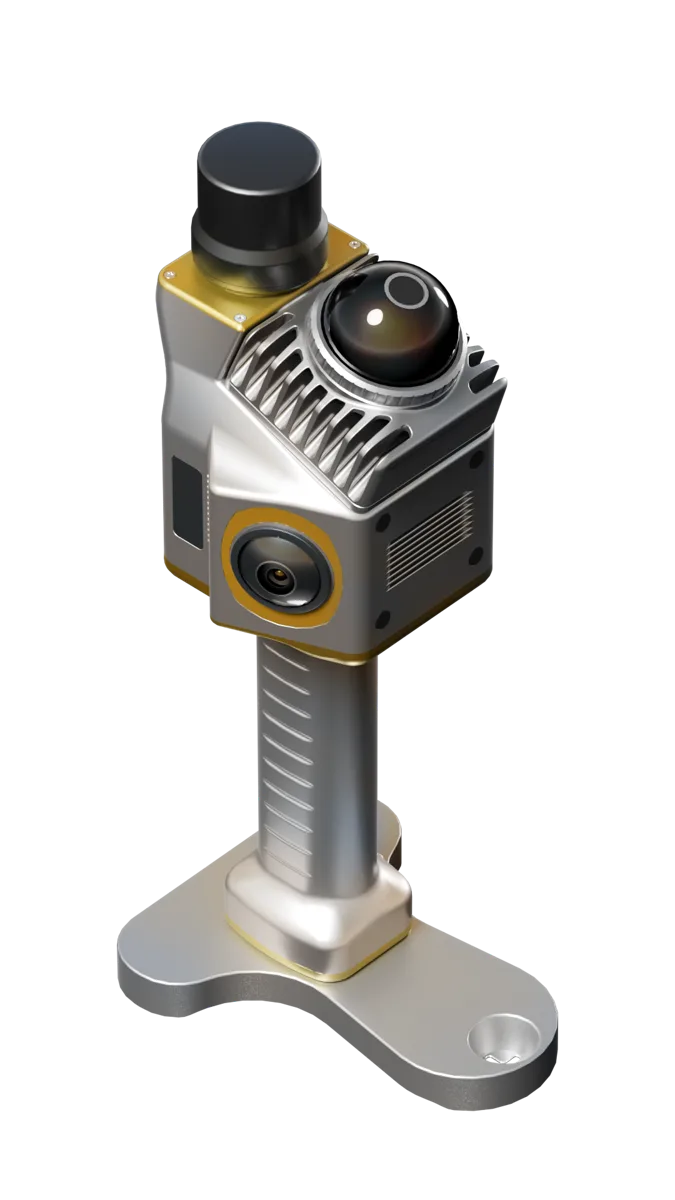
Sphere360 Handheld LiDAR Scanner
Fast. Portable. Scan-ready.
Sphere360 is a handheld LiDAR scanner for fast 3D data capture in GNSS-denied, indoor, outdoor and complex environments. It fuses LiDAR, GNSS and INS for efficient point-cloud mapping workflows.
Overview
Sphere360 is a handheld LiDAR scanner for fast 3D data capture in GNSS-denied, indoor, outdoor and complex environments. It fuses LiDAR, GNSS and INS for efficient point-cloud mapping workflows.
Specifications
Handheld LiDAR ScannerReal-time positioning precisionHandheld SLAM scanningTilt or core module performanceHandheld SLAM scanningModuleLiDARCategoryHandheld LiDAR ScannerTypeSphere360Model
Key Features
Feature summary for model comparison and purchase evaluation.All-Scene Mapping
Supports SLAM, RTK-SLAM and PPK-SLAM workflows for indoor, outdoor and mixed environments.
High-Precision LiDAR Capture
Livox Mid-360 LiDAR supports fast point-cloud collection for mapping and inspection tasks.
True-Color 3D Data
Camera-supported capture helps produce clearer point clouds for documentation and visualization.
Portable Grab-and-Go Design
Handheld workflow reduces setup time and improves efficiency for rapid site scanning.
Applications
Use this section to match the product with real overseas buyer requirements.
Underground Indoor Stairs Parking Lots Outdoor Buildings
Sphere360 can be configured for this application according to project workflow and target market requirements.
Indoor Mapping
Fast point-cloud capture where GNSS is unavailable.

Tunnel & Mine
Portable mapping for low-GNSS or underground environments.

Infrastructure Inspection
3D capture for buildings, corridors, bridges and industrial sites.

Digital Twin
Point-cloud data for model creation and spatial documentation.
Accessories
Accessory choices depend on model, application, target country and package requirement. Confirm the final configuration with Spherefix sales before quotation.
Battery Kit
Plan scanning time and spare battery requirements.
Data Storage
Confirm project storage, export format and processing workflow.

Protective Case
Field transport and shipment protection.
Training Files
Operation notes, demo data and workflow support.
Carrying Case
Packaging and protection for delivery and field use.

Battery & Charger
Confirm package list and spare power requirements.
Resources
Request product files for evaluation, quotation and distribution.Need price, distributor support or product files?
Send model, target country, quantity and application. Spherefix sales will recommend the right product path.